We spent a good part of the day today visiting the Black Canyon of the Gunnison National Park. Once in the Park we traveled the Southern Rim Road to its end and back and then traveled the East Portal Road to its end and back. And, we took a few pictures along the way.
First of all a geography lesson. The Black Canyon is a total of 53 miles long; 14 of these are in the Park. At its greatest, the walls are 2700 feet above the river. At the nearest point, the rims are only 1100 feet apart; it is a very unique and different canyon.
We stopped at the Tomichi View Point location shortly after entering the park, and this was our first view of the canyon, some 1100 feet below.
Our next stop was at the Visitor’s Center where an elaborate trail had been set up to view the canyon, 1200 feet below. Right now I will apologize for the brightness of these pictures; it was an incredibly sunny day today and there was lots of glare. Anyhow, you can see a portion of the river as it wends its way through the canyon it created. There is a large, very thin formation down there which the rangers say is about 300 feet high.
While I was doing the “elaborate trail” mentioned above, my soul mate was keeping a very careful watch on me. We haven’t decided yet if she would have come down the trail to rescue me if my breath completely went south.
This picture was taken from a location known as the “Painted Rocks”. Well okay, the rocks did have different colors, but this was not the key here. The top of the rocks on the right, with the green stuff, is the highest point over the river, at 2700 feet. The literature states that two Empire State Buildings could stand end to end here, from the river to the top. And again, there’s the river down there.
After reaching the end of the road you return. At the entrance to the park there is a second roadway, the East Portal Road, which follows the canyon down to the site of the first dam mentioned in a previous post. The road to this structure entailed dropping in altitude on a 16 % grade for close to three miles. This was quite a trip. Along the way the fields were ablaze with color and yes, that’s the gorge just beyond the fields.
Here’s a little trivia for any of you who care. Back around 1909, a six mile long tunnel was constructed from the Gunnison River to the farm country just south of here. At some later date, the diversion dam, shown here, was constructed to divert water into the tunnel or allow same to head downstream. Please don’t ask me how it works; I,m just the local photographer.
I promised you the third, or first, I don’t know which, dam in this system, and here it is. The Crystal Dam is 323 feet high, and like its comrades is unvisitable. There is a relatively long reservoir built up in front of this dam but access to it is a little difficult.
Visited Montrose in the afternoon and both of us were quite pleased with what we saw; it seems like a very nice medium size town and sure is in the center of a great area of our country. Tomorrow we will do the Northern Rim Road, which at one point was only 1100 feet from us. Tomorrow it is 85 miles.
After breakfast we headed out on our journey of about 111 miles, which took us almost seven hours. We stopped off at the 390 foot, Blue Mesa Dam, the third and most easterly of the dams, but you’ll have to take my word that it is there as there was no good place to grab a picture. I was however able to walk across the dam and get this lovely picture of the Blue Mesa Reservoir.
Following this stop we took off on the West Elk Scenic Byway Loop, Highway 92, which turned out to be a treasure. We followed this twisty, up and down, incredibly colorful highway almost to Crawford, where we turned off and headed over to the North Rim of the Black Canyon. We followed the North Rim Road for several miles, made a half dozen stops to walk out to the rim, and will present some of the pictures we took without comment. Please keep in mind that the same conditions that existed yesterday existed today. The sun was intense and reflected off of the higher rocks, giving a somewhat untrue picture of the rocks. Also keep in mind that the Gunnison River you see is a minimum of 1200 feet below the camera. We’ll follow these with a few with commentary.
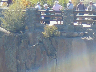
The picture below was taken at the normal lens setting, no zoom, and was taken from the Chasm View lookout on the North Rim. The arrow points to the Chasm View lookout on the South Rim. The second picture shows, albeit fuzzy, a few folks checking out the canyon from the other side. Cool, eh?
And now, by popular demand, we present the two windblown authors of this little blog.
And last, but certainly not least, we present this photo expressly for the five Cinder offspring. All five of you will have no trouble with this picture I’m quite sure.
And tomorrow we are off to follow choo-choo trains.
Thursday, March 25, 2010
Subscribe to:
Post Comments (Atom)


No comments:
Post a Comment